

Cornelius Pass Road south of the U.S. 26 on ramp is maintained by Washington County. Both U.S. 26 and Cornelius Pass Road (OR 127), north of U.S. 26, are highways maintained by the Oregon Department of Transportation (ODOT). These are heavily used roads, designed to carry a large number of travelers and commercial vehicles.
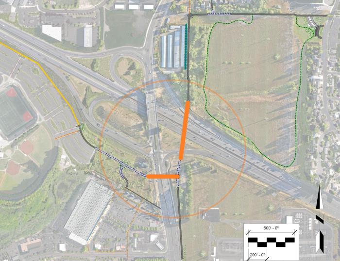
The proposed bridges will provide a safer and more comfortable alternative for people walking and biking around the Cornelius Pass Road and U.S. 26 interchange ramps.
This project only includes preliminary design of bike and pedestrian bridges over U.S. 26 and Cornelius Pass Road.
The project will define:
This project is part of Metro's Regional Trail System. The bridges and associated trail connections will link the existing segments of the Rock Creek Trail to the east and protected bikeways to the south. It will also connect to the future Crescent Park Greenway to the west and Oregon Electric Railway Trail to the north, allowing people to walk and bike to destinations throughout Hillsboro and Washington County.
Nearby destinations include:

Download:
Location map (pdf)
Bike circulation map (pdf)
Flythrough video (pdf)